
Parallelium
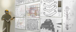
Poria-Space or Parallelium is most notable for its widespread inhabitants, the Poria. Their structure and architecture dominate and often eradicate what natural formations and geography exist. Poria are spread evenly across Parallelium, though there are congregations of them at both city-centres and notable research planet-stars and star-planets. The Poria require molten material as sustenance, as it is equivalent to both blood and food for them; their bodies cannot operate without it. The geography of Parallelium is quite diverse, though it is not easily visible. Due to their preference for uniformity and desire of ease of access, any land around or a part of a Poria settlement of any kind, be it residential, commercial, research, or government is made as flat as possible either by finding flat land or creating it.
Regions
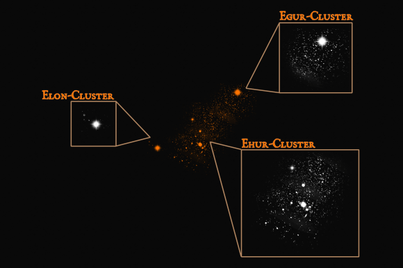
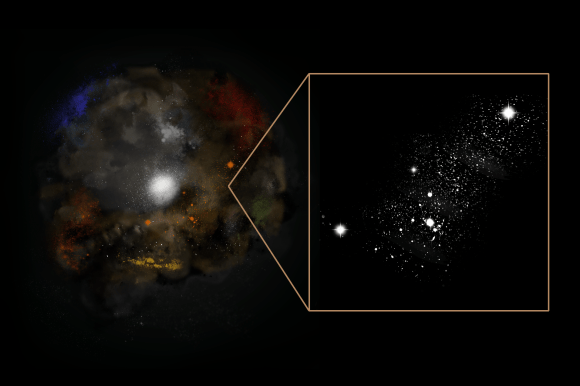
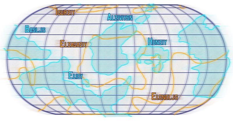
The three Regions most commonly referred to as Local Clusters—Egur, Ehur, and Elon—serve as indications of population dispersement, rather than any geographic distinction. Elon-Cluster is the most western of the three, and is the least dense as well as the smallest. Ehur-Cluster is centrally located between the other two, and is the most dense, while Egur-Cluster is located nearest The Blade and is of average/medium density.
Read More:
Locations
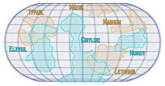
One of the three large star-planets in Parallelium, Egur-Hlasarl is the closest to Pale Shores and The Blade. After the advent of astroengineering, the star-planet was carefully designed as one of Hoyu dul Nakeil’s last proposals, however they did not live to see the engineering completed.
The three habitiable continents were designed in specific shapes for the purpose of providing different controlled environments and geographies for research. Hunziy, like all other star-planets was designed as a continent specifically for governing purposes, while Ciryloic’s long surface area covering different latitudes, while Elzviul is in synchronous orbit directly above a non-habitable continent at the closest possible distance while still being in the habitable range.
Click here to view the map at full size.
Read More:
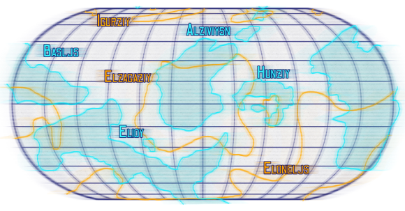
Ohr was one of the first star-planets to be astroengineered with the use of manufactured continents.1 The outer layer of continents on Ohr was constructed in 348 A.T. and in traditional Poria fashion, the first continent was named Hunziy. Some of these manufactured continents due to their age have begun to split—some have broken off and drifted such as Hunziy—but have since been stabilized.1
Roughly a century prior, Hoyu dul Nakeil developed a system that made possible the manufacturing of continents with the proper curvature to orbit uniformly around a star-core as well as their transportation to their final location from the manufacturing facility.2 These habitable continents are basic in their geographic content—made before the pori learned processes and configurations to shape continents to their will.1 Though they may be geographically plain and unvaried they do fit aesthetically with those that Porrair made herself, so they do appear natural in that sense.
Click here to view the map at full size.
Read More:
The first manufactured continent to be placed on the star-planet Ohr, it has the most significant breakage. Hunziy contains the city of Hanukish, home to the head of the system that Ohr resides in. As the capital city of Hunziy, it also oversees the branches of the star-planet’s organization.1 Due to it’s construction early in the pori understanding of continent stabilization, Hunziy has broken apart into several pieces over centuries, though most of the island containing Hanukish was saved through stabilization.
In particular, the two cities of Heiani and Heiaga were at one point the same city before the island separated. Other significant breakage happened over centuries along the southern portions of the Hoyell Oyeluean, and was the focus of several reports as understanding of stabilization progressed.
Click here to view the map at full size.

Read More:
Alziviysn is notable for its many molten processing facilities, the majority of which send the molten material around Parallelium and Omneutta. Like Hunziy the continent was created before the stabilization technology was perfected, and has pieces of the continent floating alongside. One of the broken continents of Ohr, its small size and rugged terrain are a unique combination.
Of note is the city Tclthhel, a city not directly or easily connected to any molten source. The city has been able to procure supply thanks to the private financial success of a ket by the name of Laeh Serin. This ket not only finances the city’s supply of molten material, but also the new historical society Aebrahnd Miethhas Ajika.
Like Ohr’s other continents manufactured before the pori learned how to shape continents for a truly natural look, Alziviysn has a very rugged and blocky geography These habitable continents are basic in their geographic content—made before the pori learned processes and configurations to shape continents to their will.
Click here to view the map at full size.

Read More:
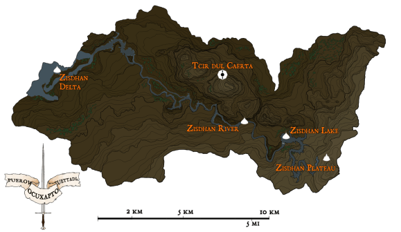
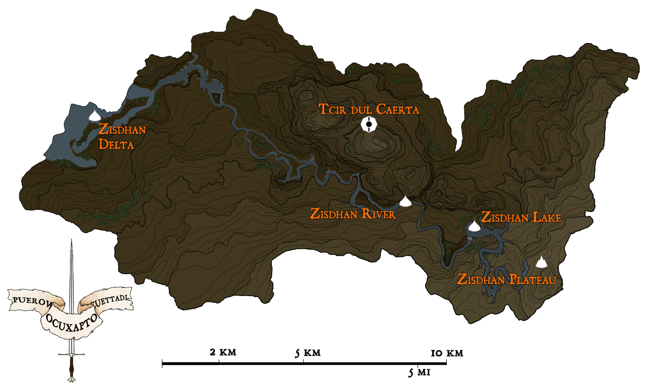
According to a document found by the Ethno-Archaeology team from the Egur-Yeil Institute of Advancement, Zisdhalilci was once the home of a thriving city of pori known as Tcir dul Caerta. In addition, no record of this city or any civilization from this planet-star exists anywhere else of record. The team investigates, documented in the Roaming with Fire series.
The documentation found by the team leads them to believe that the city was occupied shortly after the Timekeeping Reset, yet the naming convention of the city does not match Poria standards of the time.1 Now, the city is left in ruins and populated by a handful of Daekoiz. It is unknown whether the pirates encountered live on Zisdhalilci or followed the researchers to the planet-star.
Seen on the map at left, Zisdhalilci is a small planet-star, with few features. On the eastern edge sits a plateau and lake, both named Zisdhan after the planet-star. The lake falls into a river, which cuts the continent in two, with the plateau slowly sloping down into the river’s delta on the southern side, and plains with small hills to the north.
Click here to view the map at full size.
